 |
Dedication: Saint Oran Location: Iona Coordinates: 56.33376N, -6.39184W* Grid reference: NM286243* Status: destroyed? |
St Oran of Iona, an originally Irish abbot of the 6th century, accompanied the famed St Columba on his journey to Iona in 550. Oran did not, however, have long to live: according to a bizarre legend, anything that Columba built on the island during the day was destroyed by demonic forces each night, meaning that it would be impossible for him to construct a monastery. He soon realised that the only solution would be for one of his companions to be voluntarily buried alive beneath the foundations, and Oran was chosen for this role; the construction of the monastery then continued without hindrance. However, one day, Oran raised his head from the ground and shouted something heretical along the lines of "death is no great affair; hell is a mere joke". Alarmed, Columba began to bury him properly, shouting, "Earth on the head of Oran, and prevent his prattling!" Reportedly, St Oran's Chapel stands today on the site of his grave, although this is questionable as the legend itself is quite possibly fantastical.
A surprisingly small amount is known of Tobar Orain itself, especially considering its location on what is arguably the most important early Christian monastic site in Scotland. It has never been marked on Ordnance Survey maps, it is not even afforded its own entry on the Canmore database, and it has gone almost completely undocumented. Nonetheless, it certainly once played a part in St Oran's medieval cult, and it would undoubtedly have been ascribed healing powers.
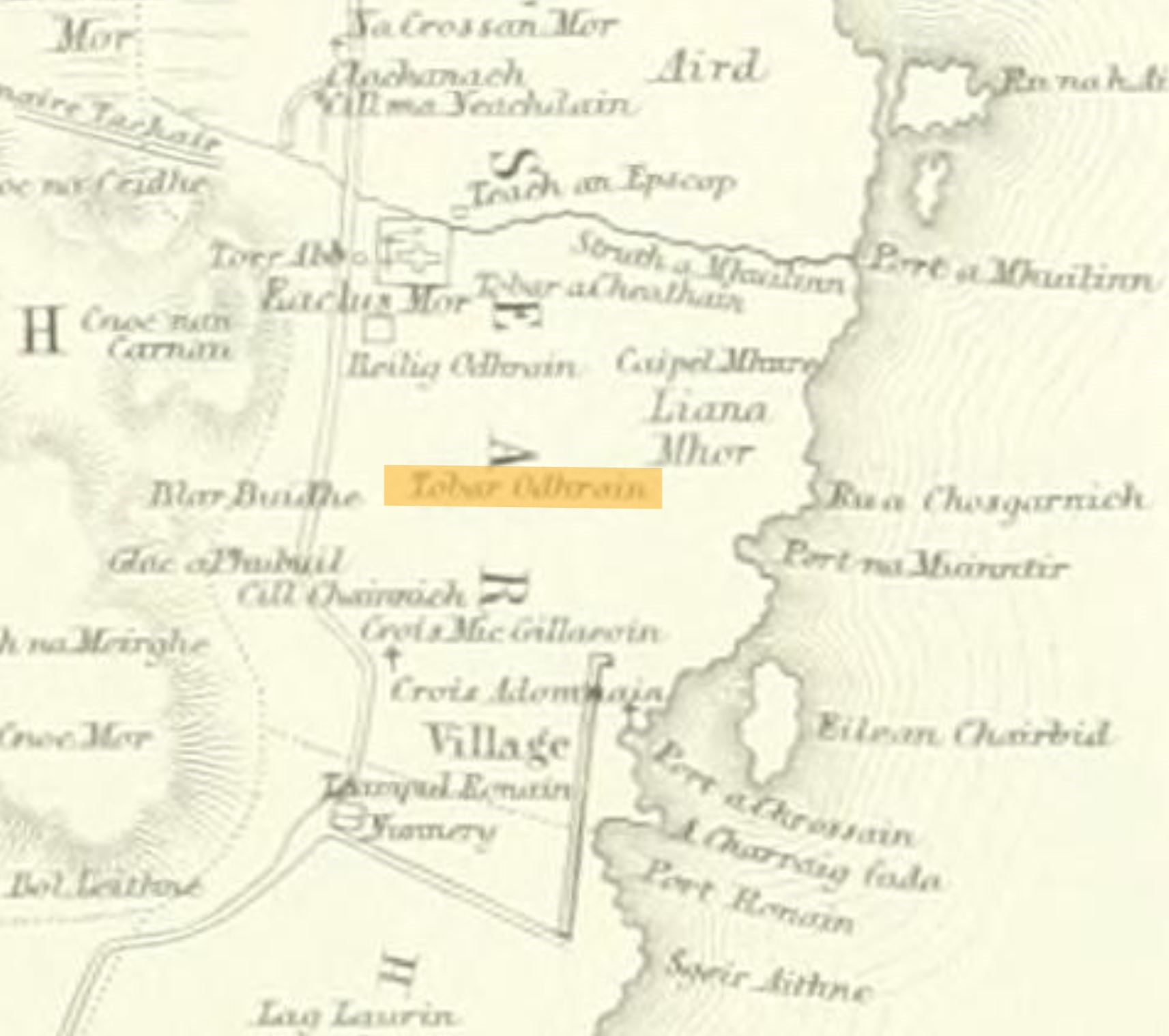
In fact, the only documentary reference to the site's existence that I have been able to find dates from 1857, when William Reeves mentioned it in Vita Sancti Columbae. He called it "Tobhar Odhrain", and stated that it is located "a little east of the Free Church manse", but said nothing of its history, or even of its association with St Oran. It is Reeves' map of the island, however, which was included in the same publication, that is really useful in pinpointing (albeit not exactly) the location of the well. Below is a very poor image of the part of the map that depicts the well, with the title "Tobar Odhrain" highlighted:
|
 |
It is not clear when exactly the well was destroyed (assuming that it was), but it has never been marked on Ordnance Survey maps, so it had probably vanished from sight by the 1880s. Of course, it is possible that the surveyors simply missed the site off the map accidentally, as is known to have happened at several other locations (notably St Chad's Well at Barton upon Humber, Lincolnshire, where the surveyors were looking in the wrong place). As such, the condition of Tobar Orain remains uncertain, and it is possible that it still survives intact.
|
Access: The field in which the well was (or possibly is) located seems to be private land. |
*Location approximate
Images:
Old OS maps are reproduced with the permission of the National Library of Scotland
Copyright 2025 britishholywells.co.uk