 |
Dedication: Saint Dogfael Location: St Dogfael's Church Coordinates: 52.01523, -4.74422 Grid reference: SN117387 Heritage designation: none |
HOME - WALES - PEMBROKESHIRE
|
Dedication: Saint Dogfael Location: St Dogfael's Church Coordinates: 52.01523, -4.74422 Grid reference: SN117387 Heritage designation: none |
St Dogfael, a 6th century missionary and the reputed cousin of St David, appears to have split much of his time between Brittany, Pembrokeshire and, possibly, Cornwall. Although his cult was evidently well-established in Brittany (according to Sabine Baring-Gould and John Fisher's Lives of the British Saints, Dogfael was traditionally "invoked to help children to walk" there), the centre of his veneration was evidently in Wales. In particular, the supposed site of his grave, located at Llandydoch (where Dogfael is reputed to have met with fellow saints Tydecho and Tegfan), was popular with medieval pilgrims; it is surely not a coincidence that Ffynnon Dogfael and its associated church, undoubtedly founded by Dogfael himself, are located only a few miles away.
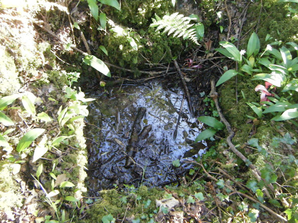
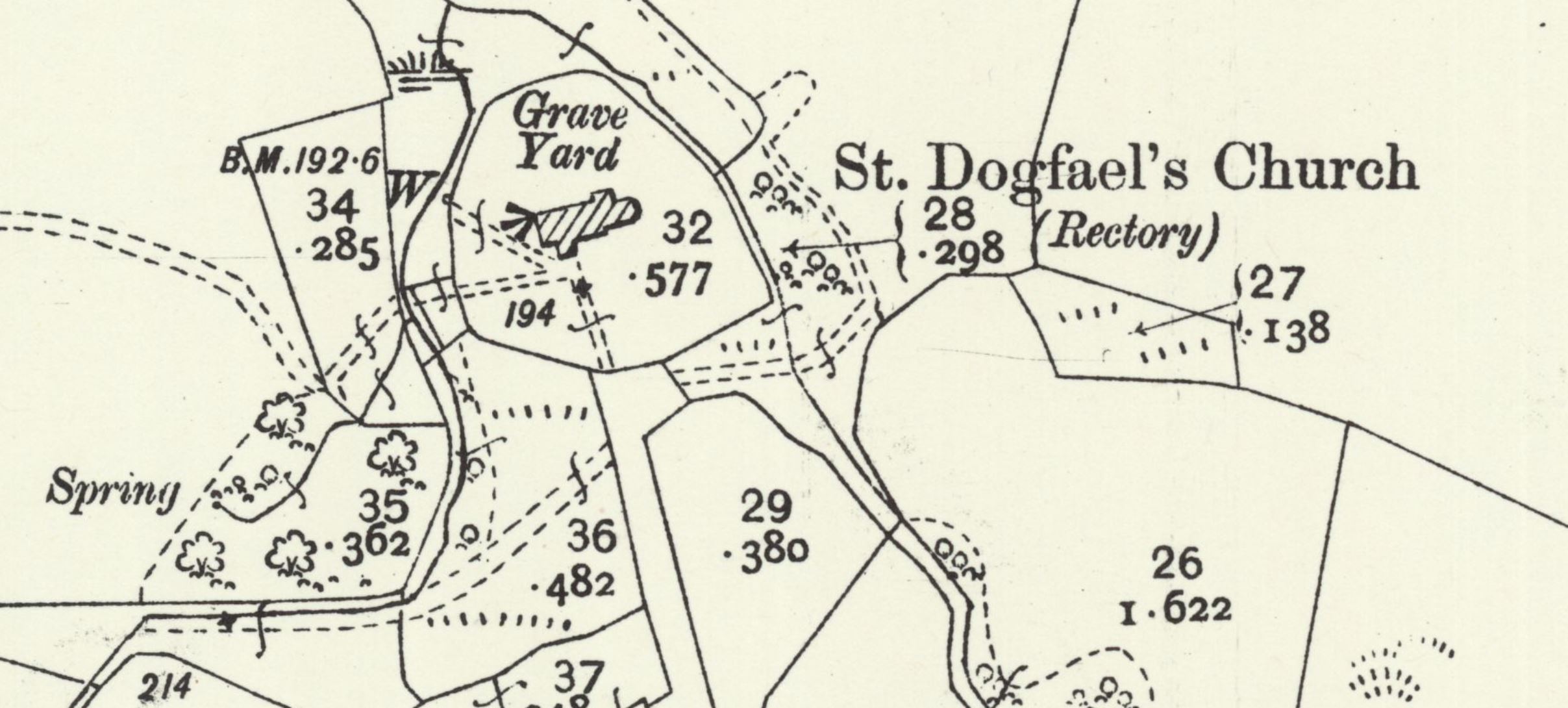
Regarding Ffynnon Dogfael itself, very little is recorded. The earliest reference that I have found to the well dates from the early 20th century, when the Royal Commission inspected the site on the 17th of June, 1920. According to the Commission's report, they found the spring "immediately outside the churchyard fence", and noted that "water for the church font was formerly taken from it". They were not informed, however, of any local traditions associated with the holy well, and made clear the fact that the "well-space precludes total immersion" or bathing. This is really the only authority for information about the site, and even Francis Jones, who mentioned the well in his Holy Wells of Wales in 1954, took all of his information from the notes of the Royal Commission. Nonetheless, Ffynnon Dogfael undoubtedly existed in medieval times, although it was evidently a very minor site.
Strangely, Ordnance Survey maps have not consistently marked the spring, and its location has only been recorded on very large scale maps. Its existence was denoted by a "W", connected to the church by a small path, on the 25-inch OS map of 1907, but not on any other editions, and it is certainly not shown on modern maps. This has led to confusion as to the exact location of Ffynnon Dogfael on the Historic Environment Record, which subsequently confounds the holy well with a nondescript "spring" that was marked on all historic OS maps at SN1172938705, just under a hundred metres south west of the church. The actual holy well is located almost directly, as the Royal Commission described, on the boundary of the churchyard.
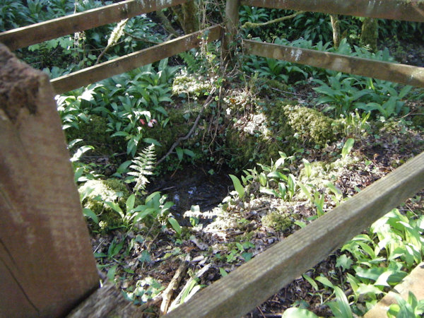
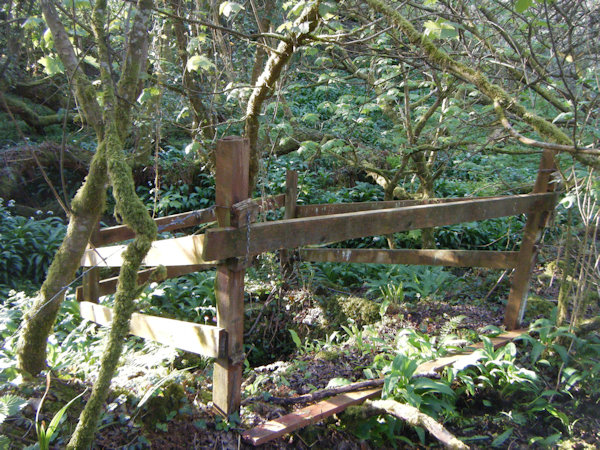
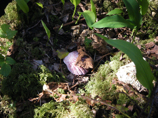
When I visited the site in April 2025, it became clear that little had changed since 1920. The well certainly was not large enough to bathe in, being a small square depression in the ground, lined with stones, measuring perhaps two feet square. The entire structure had been surrounded by a relatively new-looking wooden fence, although the stones encasing the spring were covered with moss, and there was no clear route to the site through the undergrowth. Nonetheless, its existence is evidently known by some, as a small shell had been left on part of the stonework.
It is worth noting that Ffynnon Dogfael was visited as part of the Cadw Holy Wells Project of 2011, but nothing resembling a well was found; it is likely that the site of the spring at SN1172938705 was inspected instead.
 |
 |
 |
 |
|
Access: The well is located just outside the churchyard, which is open daily. There is no clear path to the site. |
Images:
Old OS maps are reproduced with the permission of the National Library of Scotland
Copyright 2025 britishholywells.co.uk