 |
Dedication: Saint David Location: Ffynnon Ddewi Farm Status: lost |
HOME - WALES - CARDIGANSHIRE
|
Dedication: Saint David Location: Ffynnon Ddewi Farm Status: lost |
The village of Henfynyw plays an essential part in the story of St David, a 6th century bishop whose cult was the most extensive in the entirety of South Wales. According to legend, David, or "Dewi", spent his early years at Henfynyw with his mother St Non, which is not implausible, especially considering the fact that the village of Llanon, located just five miles north-east of Henfynyw, is under her patronage. Some versions of David's life even go as far as to claim that David was born in Henfynyw, which, though possible, is contrary to the more popular strain of the legend that asserts that he was born at St Non's Well near St Davids, in Pembrokeshire. Nonetheless, yet another local tradition links St David to the area, albeit less directly: reputedly, Henfynyw (meaning "old Mynyw") was the old centre of the bishopric of Mynyw, which St David became the head of. According to Thomas Morgan, writing in 1887 in The Place-Names of Wales, "the cathedral of St. David's was originally designed to have been erected" in Henfynyw, before it was decided to construct it in St Davids instead. Regardless of whether these legends hold any truth, it is clear that the medieval cult of St David had a strong presence in the village, as both the parish church, and Ffynnon Ddewi, are dedicated to that saint.
Ffynnon Ddewi most probably dates from the time of St David, or, at the very latest, the 12th century, by which time the parish church is known for certain to have been dedicated to him. The farm on which the well was (or is) presumably located has been called "Ffynnonddewi" from at least 1846, when it was named as such on the parish tithe schedule, although the earliest mention that I have found of the spring itself dates from 1833, when Samuel Lewis referred to "a spring near the church, which is still called Fynnon [sic] Ddewi" in the first volume of his Topographical Dictionary of Wales.
Apart from the fact that the well's water was undoubtedly used for baptisms in the parish church, Francis Jones, in The Holy Wells of Wales (1954), recorded another custom that was associated with the site. According to him, Ffynnon Ddewi was "visited on Midsummer Eve", the 21st of June; unfortunately Jones does not provide any more information regarding this intriguing tradition.
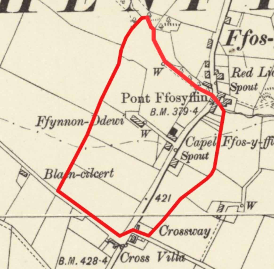
It is very unfortunate that the location of a well that was clearly relatively well-known during the Victorian era has now been forgotten. It seems clear that the well was (or is) located on land once belonging to the farm of Ffynnonddewi. Unfortunately, the tithe schedule records that none of the farm's fields had specific names, but historic Ordnance Survey maps do record three water sources located on the farm's land (the main image above shows an outline of the farm's land, overlaid onto an OS map of 1906), and one of these must be Ffynnon Ddewi:
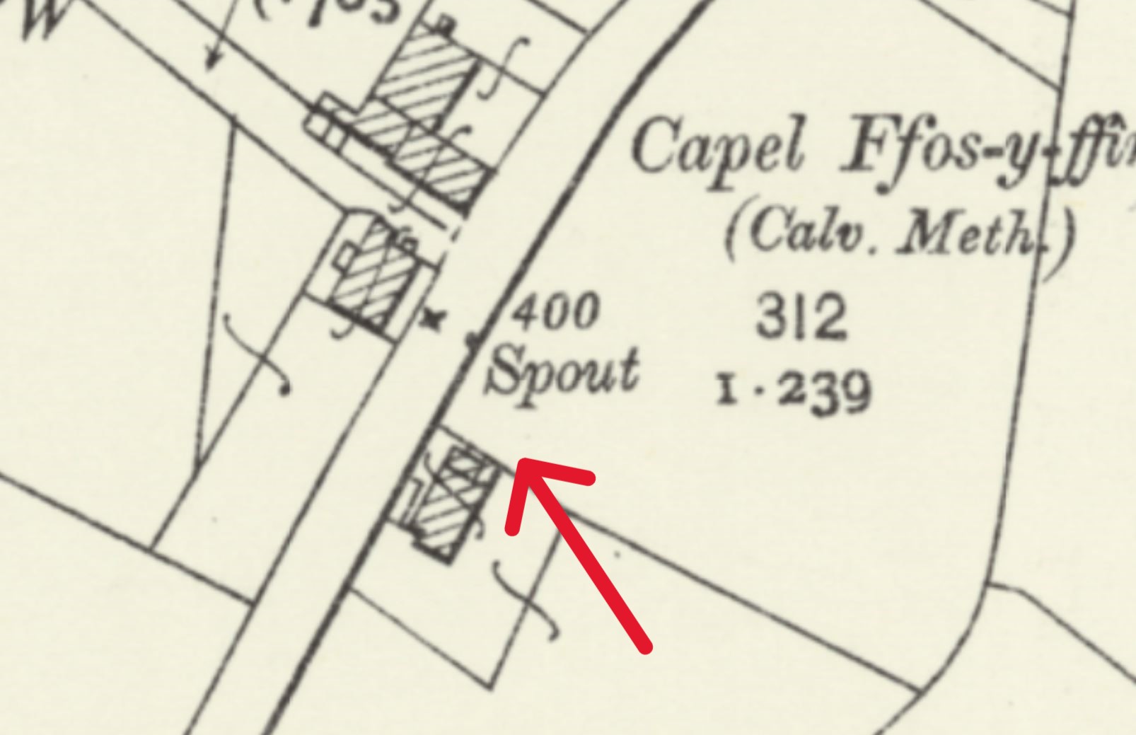
A water source located at SN4480560630, directly beside the main road through Henfynyw, marked as a "spout" on historic Ordnance Survey maps. The house next to it, reportedly constructed in the 19th century, is called "Ffynnon Ddewi"; whether this is significant is unclear. A footpath leading to it across the fields from a neighbouring farm was marked on Ordnance Survey maps, suggesting that this was an important water supply. It was located 200 metres away from the original Ffynnonddewi farmhouse, and almost 600 metres from the church. This water source appears to have been capped, and seems to survive beneath a manhole cover beside the road.
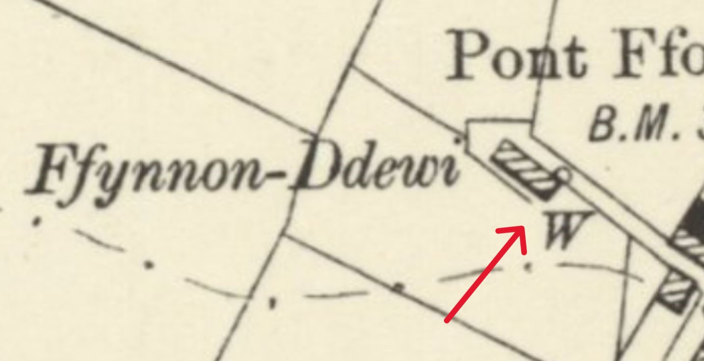
A well, marked on most historic Ordnance Survey maps (excluding first edition ones), located at SN4475460682, in the garden of the later farmhouse that replaced the original Ffynnonddewi. By the 1880s, when the first Ordnance Survey maps were published, the old farmhouse had been demolished and moved to its present location, but tithe maps show that it was originally situated at SN4475860816. This well was visited by Cadw, who assumed that it was Ffynnon Ddewi, as part of their Holy Wells Project of 2011, and they described it as "circular and drystone lined, with water visible at some depth". From this description, it sounds as though this was a deep well, which would mean that it certainly is not Ffynnon Ddewi (true holy wells are always springs). This well has now been filled in, and no trace of it remains. It was located just over 500 metres from the church.
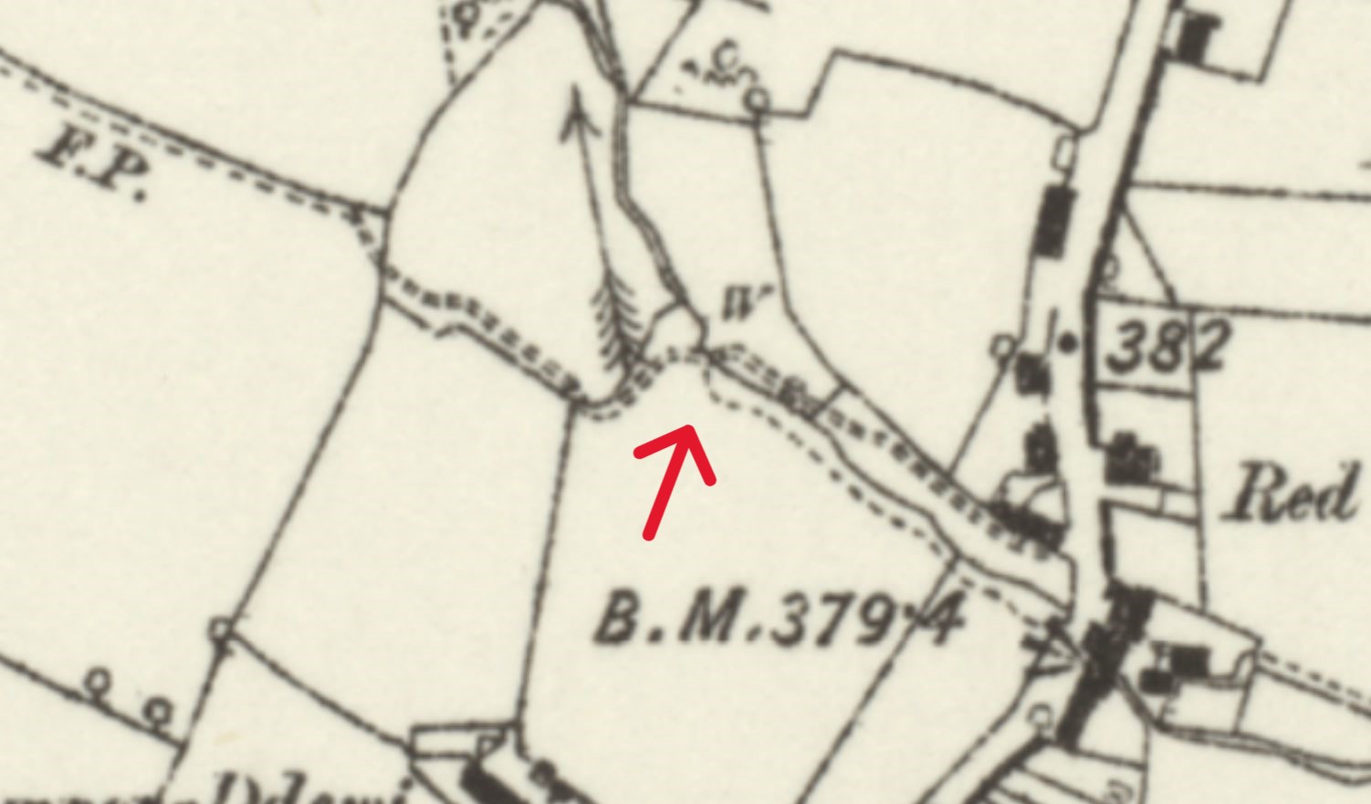
A well located at SN4478860783, only metres from the original farmhouse of Ffynnonddewi, and just over 400 metres from the church. It was clearly the farm's original water supply. The 1889 6-inch Ordnance Survey map of the area shows a public footpath leading to the well from the village, which indicates that the site once had significance locally; by the early 20th century, this footpath had vanished. This is the most likely of the three to be Ffynnon Ddewi, because of its proximity to the church and the original farmhouse, and because of the fact that it was once located on a public footpath.
Images:
Old OS maps are reproduced with the permission of the National Library of Scotland
Copyright 2025 britishholywells.co.uk