 |
Dedication: Saint Kilda Location: Hirta Coordinates: 57.81455N, -8.57092W Grid reference: NF100995 Heritage designation: Scheduled monument |
HOME - SCOTLAND - WESTERN ISLES, ORKNEY AND SHETLAND
|
Dedication: Saint Kilda Location: Hirta Coordinates: 57.81455N, -8.57092W Grid reference: NF100995 Heritage designation: Scheduled monument |
Tobar Childa Chalda, also called "St Kilda's Well", is perhaps the only holy well in Britain to be dedicated to a completely non-existent saint. In fact, the alternative name of Hirta, "St Kilda", is thought to have originated through a 16th century cartographic error. Roughly 34 miles from Hirta are the Haskeir Islands, which were dubbed the "Skildir" (meaning "Shield") by the Vikings, and which were so named on very old medieval maps; it appears that a late 16th century cartographer misinterpreted these old maps and accidentally both attributed the name to Hirta, and misread "Skildir" as "S. Kildir". Medieval maps are notoriously inaccurate, so it is no surprise that this error occurred. However, as the name "Saint Kilda" only dates from the latter decades of the 1500s, the name and dedication of the holy well must be post-medieval. This leaves two possibilities: firstly, the well may originally have simply been a medieval "holy well" with no patron saint, or, secondly, the site was constructed in the 17th century as a sort of folly. In this case, it is impossible to tell which explanation is the most likely.
Regardless of whether the well is truly medieval or not, it certainly existed by 1697, when Martin Martin embarked on a tour of the Western Isles of Scotland, visiting Hirta and describing it in his Description of the Western Isles. By this time, the idea that Kilda was a real saint was clearly accepted, and Martin claimed that "Kilder" once lived on the island and had given his name to "a very large Well near the Town", called "Tonbir Kilda", or "St. Kilder's Well". Kenneth Macaulay, writing in his History of St Kilda (1764) almost a century later, called the well "Tober Childa Chalda", and described its water, which was "of univerſal uſe to the community", as being "ſweet, light and clear like cryſtal". Macaulay was certainly referring to the same well as Martin, as he noted that it was "near the heart of the village".
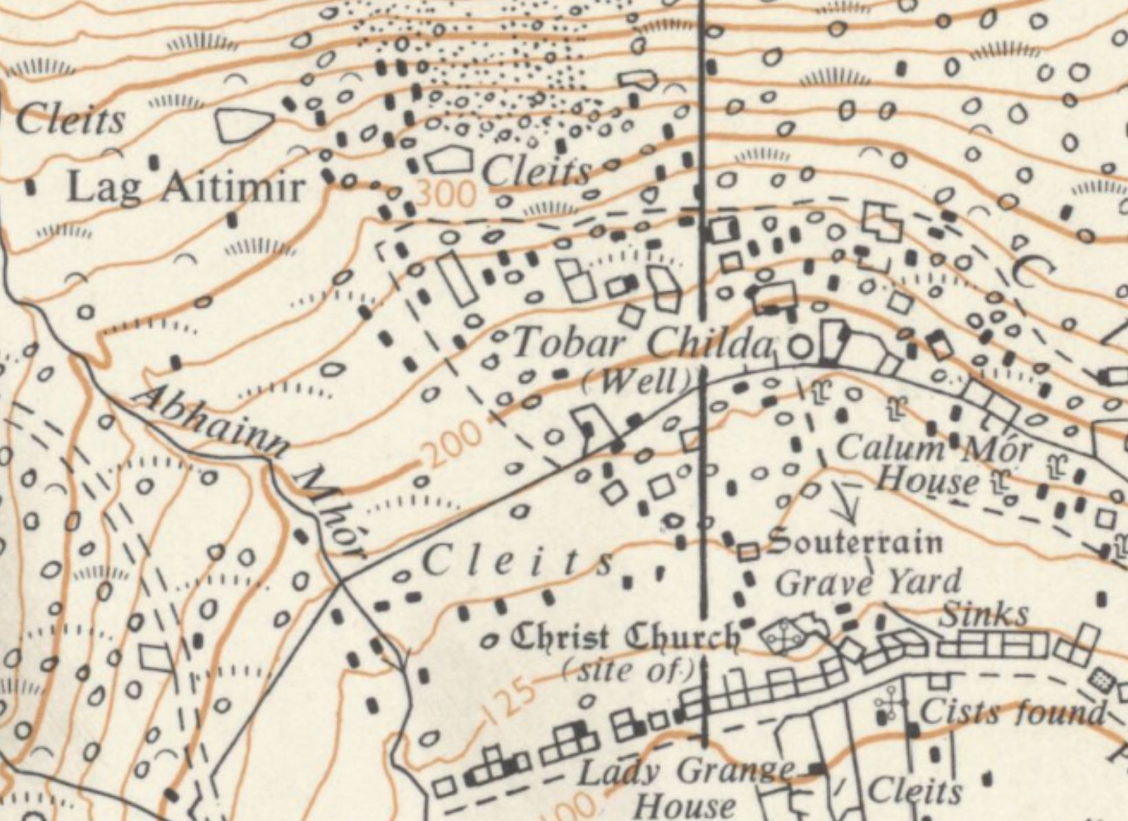
It is not clear whether the well was ever used for healing purposes, like the neighbouring Well of Virtues famously was, but the fact that it does not appear to have been suggests that Tobar Childa Chalda was not a holy well during medieval times. The site was, nonetheless, both marked and named (as "Tobar Childa") on the one Ordnance Survey map that has ever been made of Hirta, dating from 1970. The surveyors for this map described the well as being "uncovered", the water issuing "from between rocks". Today, the well, though not named, is still marked on Ordnance Survey maps.
|
Access: The well is publicly accessible. |
Images:
Old OS maps are reproduced with the permission of the National Library of Scotland
Copyright 2025 britishholywells.co.uk