 |
Dedication: Saint Mary the Virgin Location: Nemphlar Coordinates: 55.68225N, -3.81519W Grid reference: NS859446 Heritage designation: none |
HOME - SCOTLAND - LANARKSHIRE
|
Dedication: Saint Mary the Virgin Location: Nemphlar Coordinates: 55.68225N, -3.81519W Grid reference: NS859446 Heritage designation: none |
There was once a medieval chapel of St Mary at Nemphlar, the remains of which could still be seen in the 1830s, but which are now long gone. It is said to have been constructed by the Knights Templar, who owned the surrounding land. Undoubtedly, this chapel had a direct connection with the nearby holy well, and, almost certainly, water from the spring would have been taken to the chapel for baptismal purposes.
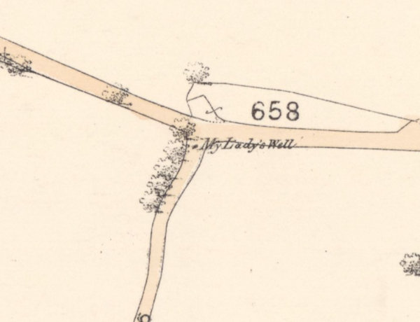
Nothing is known of the history of My Lady's Well, which has gone completely undocumented for centuries. The earliest reference to its existence that I have been able to find dates from 1838, and takes the form of a "plan of the lands of East Nemphlar sold by Thomas Gairdner Esq. to Sir Norman Macdonald Lockhart", which marks a "Lady Well Park". The site has always been marked and named on Ordnance Survey maps, to this day.
|
Access: The well is located on private land, but it can be seen through a gap in the hedge at the side of a quiet road. |
Images:
Old OS maps are reproduced with the permission of the National Library of Scotland
Copyright 2025 britishholywells.co.uk