HOME - SCOTLAND - EDINBURGH
St Roque's Well, Edinburgh
Dedication: Saint Roch
Location: Burghmuir
Status: lost (and probably destroyed)
|
In medieval Edinburgh, victims of the plague were sent, according to the Canmore database, to the Burghmuir, where they were isolated from the general population, and here buried. In the early 16th century, a chapel dedicated to St Roch (corrupted to "Roque") was constructed here, reportedly by the town council, for the use of the afflicted, and it is no surprise that the site was put under the patronage of St Roch, the patron saint of those afflicted by the plague. Roch was a 14th century saint, said to have been born in Montpellier in the early 1300s, and to have tended to the sick during an outbreak of plague in Italy. Although his cult developed comparatively late, he quickly became strongly associated with the Black Death in Europe.
It is not certain when exactly this chapel was built, but it definitely existed by 1507, when (according to the Treasurer's Accounts for that year) James IV made an offering of thirteen shillings, equivalent to around £600 today, to this chapel on St Roch's feast day, the 15th of August (some later sources give the date as the 16th of August and the offering as 14 shillings). There can be no doubt that it was to this chapel that the entry in the Treasurer's Accounts refers, as the existence of two charters that were signed by James IV on that very day (whether the 15th or the 16th is unclear) prove that he was in Edinburgh at the time. The Canmore database places the construction of the chapel somewhere between the years of 1501 and 1504.
Very little is recorded about St Roque's Well itself. Without a doubt, it was either built with the chapel, or came into existence shortly afterwards, making it one of the latest medieval holy wells to appear in Scotland, and perhaps in all of Britain. It most probably attained its name after its water was used for baptisms at the chapel; although this may seem an unlikely ceremony to take place at this particular site, Sir Walter Scott recorded in his Provincial Antiquities (1834) that an old font could still be seen in the ruins of the chapel until its demolition, and it is likely that water from this well would have filled it.
Regardless of its age, the earliest reference that I have found to the well's existence appears in a piece written by W. M. Bryce in The Book of the Old Edinburgh Club, in 1918. Bryce noted that, in 1701, the well was "visited by the Town Council and neighbours at the riding of the marches", and that in the "contemporary report", it was described as "St. Simon Rouges Well". However, no further information about the site is known, and Bryce himself did not afford the well more than a few sentences.
St Roque's Chapel survived in a very ruinous state until 1791, when it was finally demolished. It seems to have survived for such a long time because, according to Hugo Arnot, writing in 1779 in The History of Edinburgh, of the "ſuperſtitious awe of the people". Arnot described the attempted demolition of the chapel in around 1750, which had gone horribly wrong and had postponed its destruction further:
|
About thirty years ago, the proprietor of this ground employed maſons to pull down the walls of the chapel; the ſcaffolding gave way; the tradeſmen were killed; the accident was looked upon as a judgment againſt thoſe who were demoliſhing the houſe of God. No entreaties nor bribes by the proprietor could prevail upon tradeſmen to accompliſh its demolition.
|
Whilst it is not certain that St Roque's Well survived the destruction of the chapel, it is quite unlikely that it was destroyed at this time. Although its exact location has never been recorded, three water sources were marked on the 1853 Ordnance Survey town plan of Edinburgh, in the immediate vicinity of the chapel; almost certainly, one of these must have been St Roque's Well:
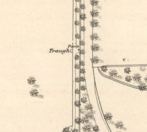
A pump and trough marked roughly at NT2527971464 on the OS town plan, roughly 50 metres from the site of the chapel. This was marked on the 1881 town plan, but was later destroyed and does not survive today.
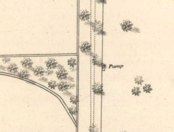
A pump, located directly east of the previous one, at approximately NT2541071436. This was also located roughly 50 metres from the chapel's site, and was also later destroyed.
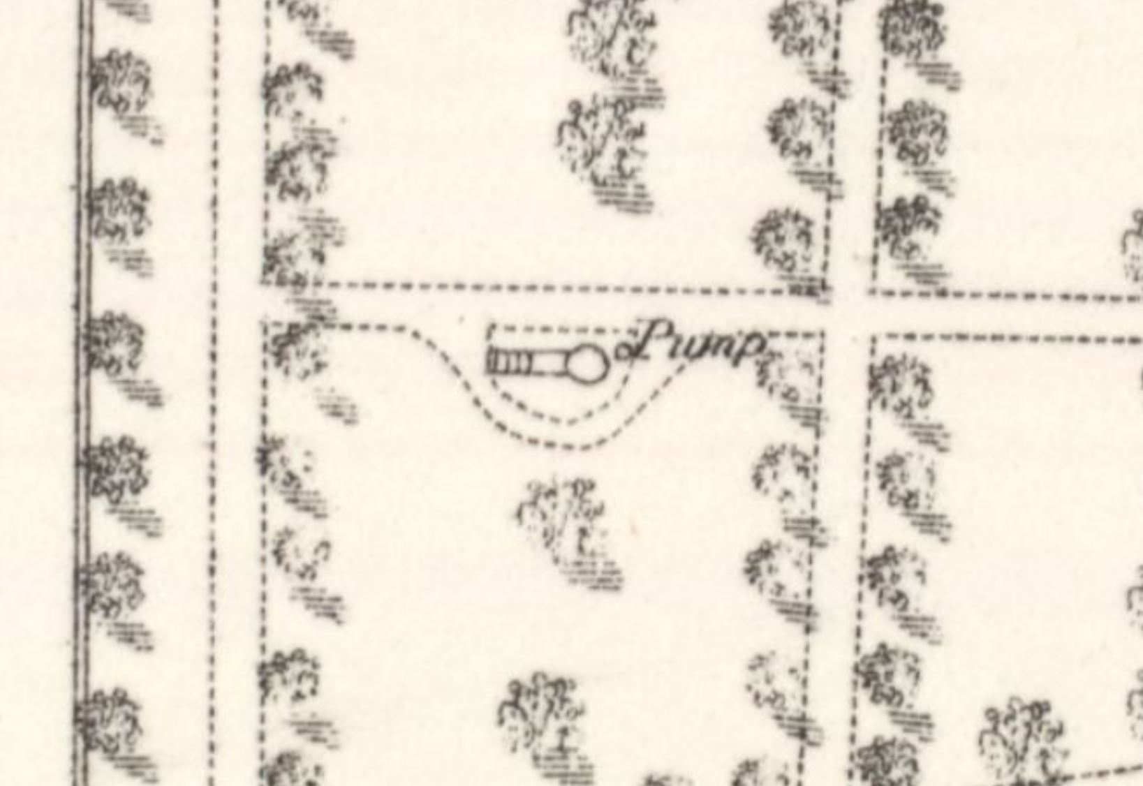
A water source marked as a pump on the 1853 town plan. On the 1881 town plan (shown below), it was marked as being next to a mysterious structure, that most probably was a well or spring of some kind. It was located around 100 metres from the site of the chapel, at NT2529771316, and also appears to have been destroyed.
Images:
Old OS maps are reproduced with the permission of the National Library of Scotland
Copyright 2025 britishholywells.co.uk