 |
Dedication: Saint Patrick Location: The Mardale Inn Coordinates: 54.55596N, -2.75194W Grid reference: NY514181 Status: covered |
HOME - ENGLAND - WESTMORLAND
|
Dedication: Saint Patrick Location: The Mardale Inn Coordinates: 54.55596N, -2.75194W Grid reference: NY514181 Status: covered |
It has been suggested that Bampton parish church's dedication to St Patrick came about as the result of a 13th century error. Historically, the parish was split into two manors: Bampton Patrick, and Bampton Cunedale; the latter gets its name from that of the Cunedale family, who once owned this half of the parish, whilst the former most probably gets its name from Patrick of Culwen (or "Curwen"), who owned the other half during the 12th century. Although it may simply be a coincidence that the patron saint of the parish shares the same name as the owner of it, it is possible that the 13th or early 14th century inhabitants of Bampton assumed that this "Patrick" referred to the saint, and thus supposed that the dedication of the church must be to that saint. Nonetheless, the church was dedicated to Patrick by 1362, at the very latest, when it was described as "ecclesie Sci Patricii de Bampton".
However, as St Patrick was active in the area (he is thought to have preached at Patterdale, which is located only 8 miles from Bampton) it is not impossible that the church and well do possess an authentic dedication to him. The holy well is located too far from the parish church to have been feasibly used for baptisms, so it is probable that the well did not take its name from that of the church, suggesting that the medieval cult of St Patrick was present in the parish. Because of this, it is likely that the association of Bampton with Patrick of Culwen is simply a coincidence.
Very little information has ever been recorded about the well itself. In 1713, it was reportedly described as "St Patrick's Well dedicated to ye St. of ye church", but no traditions regarding it are known. At some point during its history, probably after the Reformation, the site acquired the alternative title of "Mab Well", supposedly from the name of a mysterious "inmate", about whom nothing is, likewise, known.
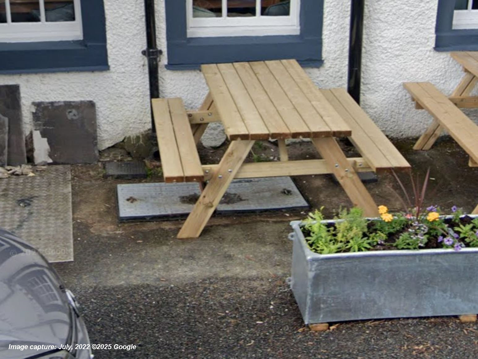
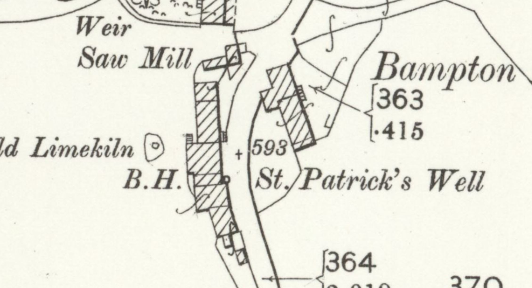
Despite the fact that some sources claim that the well is located inside The Mardale Inn, historic Ordnance Survey maps indicate that the spring was actually located just outside the building, beside the road. This well was both marked and named (as "St Patrick's Well"; this clearly did not refer to the pub) on Ordnance Survey maps until 1972, when the spring appears to have been capped, and covered with a manhole cover. This cover can still be seen beside the road today; beneath it, St Patrick's Well presumably still survives.
 |
|
Access: The manhole cover is located beside a public road. |
Images:
Old OS maps are reproduced with the permission of the National Library of Scotland
Copyright 2025 britishholywells.co.uk