 |
Dedication: Saint Anthony of Padua Location: Crookes Coordinates: 53.38638N, -1.51433W Grid reference: SK324878 Status: capped Heritage designation: none |
HOME - ENGLAND - WEST RIDING
|
Dedication: Saint Anthony of Padua Location: Crookes Coordinates: 53.38638N, -1.51433W Grid reference: SK324878 Status: capped Heritage designation: none |
St Anthony of Padua, a Portuguese saint of the late 12th and early 13th centuries, is traditionally regarded as being the patron saint of pigs, and it is perhaps for this reason that a holy well in Crookes bears his rather unusual dedication. According to A Glossary of Words Used in the Neighbourhood of Sheffield, written in 1888 by Sidney Oldall Addy, pig farming was originally very common in this area, because the "oak forests" in the vicinity were "convenient for the feeding of swine". As the patron saint of these animals, St Anthony appears to have been quite popular in the area, and there is evidence to suggest that, locally, his medieval cult was very strong. In his Glossary, Addy recorded a local custom involving the vowing of one pig in every litter "to this saint", with the youngest, according to Addy's Early Condition and Settlement of Hallamshire (1893), usually being given the name "Anthony". Additionally, the Glossary makes reference to a field named "Anthony Field" located in Dore, not far from St Anthony's Well; it is impossible to tell whether the two sites were ever connected.
Intriguingly, the existence of a link between Ecclesfield Church (located in the neighbouring parish) and St Anthony's cult is implied by an ambiguous reference, found in the churchwardens' accounts of the early 16th century, to "Sant Antony moneye". A complete transcription of these records was published in 1878 in The First Book of the Marriage, Baptismal, and Burial Registers, of Ecclesfield Parish Church, etc. by Alfred Scott Gatty, and, under "1535-1536", the following text appears:
|
It[em]. ther is in the hands of Petur Pkyne of Sant Antony moneye ... xjs. & ijd. |
Eleven shillings and two pence, the amount given in the churchwardens' accounts, is equivalent to roughly £330 today. Although it is not clear what exactly "Sant Antony moneye" was, or why "Petur Pkyne" was in possession of a portion of it, "Sant Antony moneye" is likely to have been a title given to income that was generated by the saint's local cult; it is worth noting that this record pre-dates the Reformation. There is, therefore, a high chance that this refers to offerings to a shrine or altar of St Anthony, perhaps located at Ecclesfield Church (throughout the medieval period, even smaller parish churches possessed multiple altars or shrines). Regardless of what exactly it refers to, this record clearly illustrates the popularity of St Anthony in the area during the late medieval period.
St Anthony's Well itself may well have had some connection to "Sant Antony moneye", or, at the very least, to the custom of dedicating local pigs to the saint. Unfortunately, however, I have only found one reference to any traditions that were directly associated with the spring: the fact that it was traditionally believed to possess healing powers. This custom was recorded by Addy in 1893, in The Early Condition and Settlement of Hallamshire, in which it is stated that the "inhabitants of Crookes" once believed that the spring could "cure various diseases", although Addy implied that the belief died out around "forty years" previously. I have been unable to ascertain what, if any, ailments the water was specifically used to heal.
It is interesting to note that a review of The Early Condition and Settlement of Hallamshire, published in The Edinburgh Review in 1893, claims that a "patient" wanting to experience the "full virtue of the chalybeate" well must "drink on the other side of the wall" to the two stone troughs that were once present at the site; this would suggest that St Anthony's Well was still used for healing purposes until at least 1893, contrary to Addy's report. However, The Edinburgh Review's statement seems to be unsourced, and is certainly not supported by any of Addy's own remarks, so it seems likely that this is either incorrect, or simply a reference to the general fashions of the time.
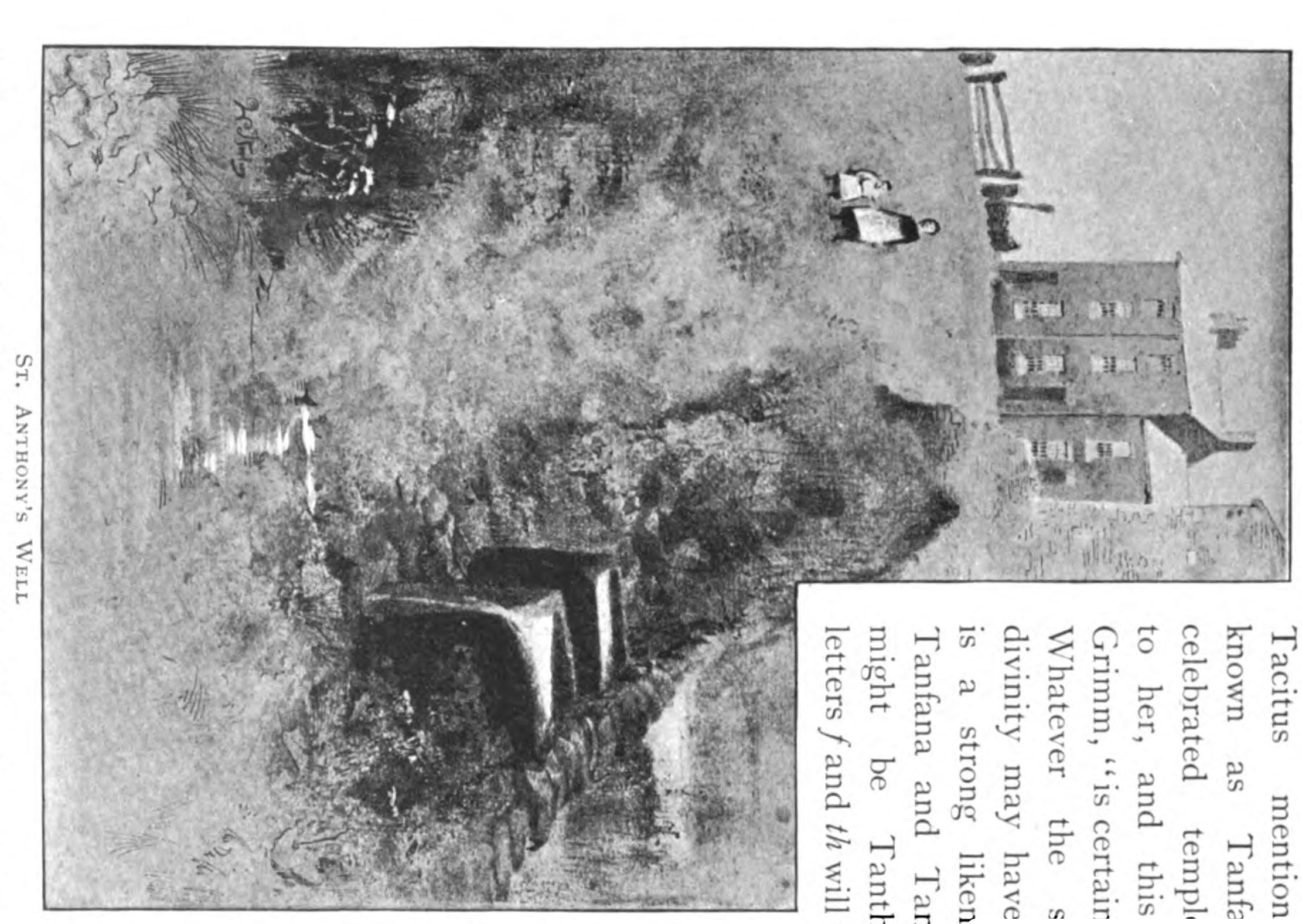
Unfortunately, it is not clear what exactly St Anthony's Well would have looked like during the medieval period, and the earliest reference to the site's appearance that I have found dates from 1893, when Addy published an illustration of the spring in his Early Condition and Settlement of Hallamshire. This illustration shows that the spring's water once issued into a set of two troughs, before making its way down the hillside; Addy confirmed this by asserting that St Anthony's Well "has been divided by a stone wall, so that the spring is on one side of the wall, and stone troughs on the other". Although it is impossible to tell when these troughs were installed, presumably in the place of a different, older structure, it is obvious that they must have been placed at the site after the Reformation. Despite the fact that Addy himself recorded that the well's structure had been "considerably altered" from its original form, it appears that he was simply referring to the building of the stone wall through the middle of the construction.
 |
This structure seems to have survived intact until around 1963, when the construction of the surrounding housing estate was completed, the spring undoubtedly being capped at this stage. Of course, as Ordnance Survey maps are the only historical sources that mention St Anthony's Well, following the publication of Addy's books, it is possible that the troughs were removed at an earlier date, and that only the spring then remained. Either way, the only OS map that explicitly depicts the two troughs is, unfortunately, the 1893 25-inch map of Crookes, which, being published at the same time as The Early Condition and Settlement of Hallamshire, is useful only in the fact that it corroborates Addy's description. From this point onwards, OS maps continue to mark and name the spring, but do not shed any light on its structural appearance. Until about 1923, OS maps show that the well was situated in open fields, which were first turned into "Allotment Gardens", until the construction of housing estates began on the hillside. By 1956, St Anthony's Well was surrounded on almost all sides by houses, although it was still in existence until roughly 1963, when a number of houses were built to the east of the spring, and it was covered over.
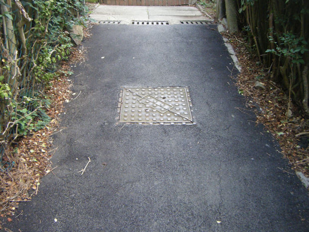
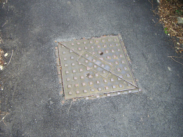
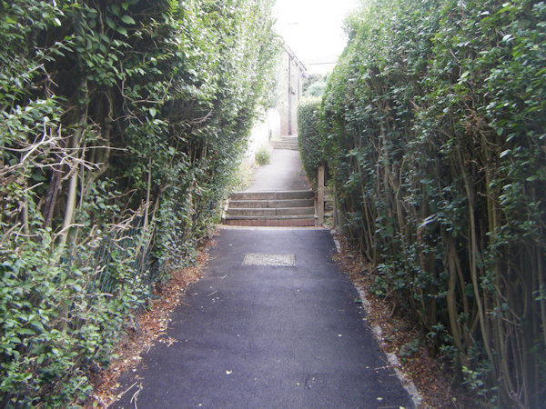
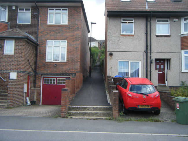
When I visited the site in August 2025, I was not surprised to find that nothing had changed in the last six decades. I used GPS, in conjunction with my map, to ascertain that the manhole cover pictured on this webpage is located on the exact site of the original well, as shown on historic OS maps. In fact, it is clear that the spring still survives, as it was possible to hear it, albeit quite faintly, trickling away beneath the cover.
 |
 |
 |
|
Access: The well is located in the centre of a public footpath that leads up the hill; this footpath was originally Hagg Lane, a path leading from the base of the hill to St Anthony's Well. |
Copyright 2025 britishholywells.co.uk