 |
Dedication: Saint Gilbert? Location: Sempringham's church Coordinates: 52.88164N, -0.35655W Grid reference: TF106328 Heritage designation: Grade II listed building |
HOME - ENGLAND - LINCOLNSHIRE
|
Dedication: Saint Gilbert? Location: Sempringham's church Coordinates: 52.88164N, -0.35655W Grid reference: TF106328 Heritage designation: Grade II listed building |
St Gilbert was the founder, in 1131, of the only completely English monastic order ever to be created: the Gilbertine Order. As such, this order completely died out after the Dissolution of the Monasteries; records cannot agree on the exact number of Gilbertine houses that existed by this time, but they were spread across the country and did not just exist in Lincolnshire. Gilbert lived during the 12th century, and he is reputed to have lived to the ripe old age of 106 (the authenticity of this claim is doubtful), between the years of 1083 and 1189. During his long life, he actively worked to spread the Gilbertine Order, and founded several monasteries before his death. This holy well is often called "St Gilbert's", which may or may be not be accurate: there is no historical evidence to prove that it was ever officially associated with him, but it is extremely likely.
Quite to my surprise, I have been unable to glean much information at all about this holy well. According to the Lincolnshire Historic Environment Record (of course, this is not always a reliable source), the structure of the well dates from the 12th century, but has "some 19th and 20th century alterations"; this, if true, would place its construction either during or directly after Gilbert's life. As this spring would have been so close to the abbey and to the original village of Sempringham, it almost certainly was the settlement's main water source, so it may initially simply have been an ordinary spring that was built around because of its usefulness, and which became associated with Gilbert's cult later on. The earliest reference to this well that I have been able to find dates from 1882, and can be seen in William White's History, Gazetteer, and Directory, of Lincolnshire, and the City & Diocese of Lincoln, in which he mentions "a beautiful spring of water" located near to the church.
When the first Ordnance Survey map of the area was published in 1888, the spring was marked as a "Holy Well", which indicates the existence of a local tradition that has managed to escape any documentation.
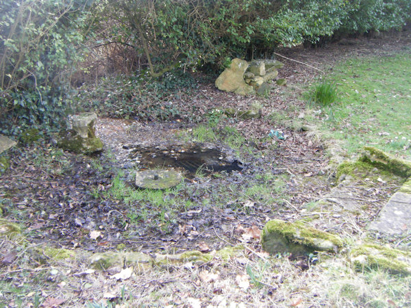
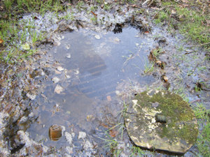
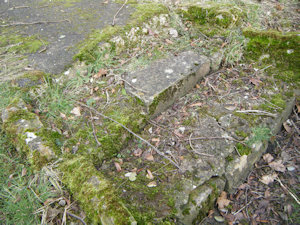
Today, the Holy Well can still be seen to the south of St Andrew's Church. When I visited the site in the February of 2025, the spring was producing a considerable quantity of water, although it was swamped with leaves. Aside from its chalybeate appearance, the water did have an almost oily scum on its surface, and the decomposing leaves did not help the water quality: certainly not a well to drink from! When I cleared some of the leaves away from the source, the stone surround of the spring could be seen relatively clearly. Overall, the site was in good condition, except for the leaves and the scum.
 |
 |
|
Access: The well is publicly accessible at the edge of the churchyard. |
Copyright 2025 britishholywells.co.uk