 |
 |
HOME - ENGLAND - LANCASHIRE
Dedication: none Location: All Hallows' Church Coordinates: 53.85664N, -3.037W* Grid reference: SD318405* Status: destroyed |
Very little is recorded regarding Bispham's holy well. Although it almost certainly existed in medieval times, and clearly had a direct link to the parish church, the earliest reference that I have found to the site dates from the mid-19th century. In 1852, a piece published in the Transactions of the Historic Society of Lancashire and Cheshire, which suggested that All Hallows' Church had pre-Christian origins, mentioned a "sacred well in the garden adjoining" the church. Edward Baines, writing in The History of the County of Palatine and Duchy of Lancaster in 1867, validated this in his statement that the "Holy well" was located near the church in "a neighbouring garden, with its old covering".
However, when Mr G. C. Yates, a member of the Society of Antiquaries, "visited the spot" in the December of 1902, he found, according to an article included in the Transactions of the Lancashire and Cheshire Antiquarian Society in 1903, that the cottage to which the garden and well belonged had been "demolished", and the spring had subsequently been "filled up". Nevertheless, Yates appears to have managed to speak to the previous inhabitant of the cottage, who reportedly remarked that the Holy Well had been "a grand spring" that "always" sported "a nice scum".
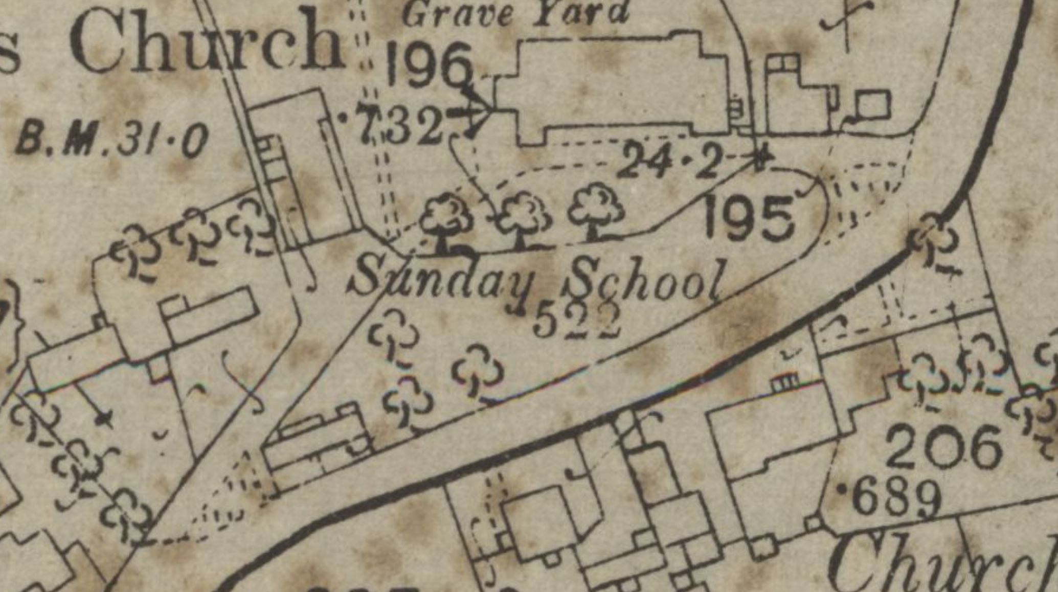
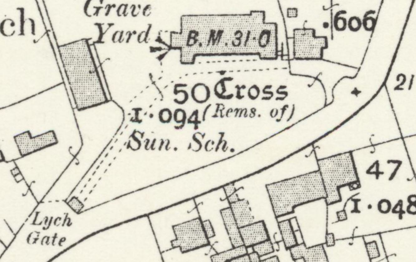
According to the Historic Environment Record, the Holy Well was filled in "when the churchyard was extended", but was "re-discovered in 1935 by the sexton", whilst he was digging a grave at roughly "SD 31884053". For once, the database may actually be correct: the 1892 25-inch OS map of the area depicts what appears to be a garden, separate from the churchyard, between the church and All Hallows' Road; in the west of this garden is a small building that may well have been a cottage. This is also shown on the slightly later 1895 6-inch OS map, although the building had clearly been demolished by 1912, and later maps show this garden area as being a part of the churchyard, as it remains today. Evidently, the cottage and garden were destroyed in order to enlarge the churchyard. Intriguingly, the grid reference provided by the Historic Environment Record, SD31884053, does place the well within the bounds of this garden, so it is likely correct. It is worth noting that although no historic Ordnance Survey maps mark a well or spring at this location, that is not to say that one did not exist there, as OS surveyors regularly failed to find holy wells, or mark them on the map, particularly if there was a lack of available space.
Despite the fact that the sexton reputedly uncovered the well, or its remnants, around a century ago, he must have filled it in again because nothing remains at the site today.
|
|
*This is the location given by the Historic Environment Record, and, as such, may be slightly inaccurate
Images:
Old OS maps are reproduced with the permission of the National Library of Scotland
Copyright 2025 britishholywells.co.uk