 |
Dedication: Saint Anthony Location: Coxbench Coordinates: 52.988525N, -1.4479839W* Grid reference: SK371436* Status: destroyed |
HOME - ENGLAND - DERBYSHIRE
|
Dedication: Saint Anthony Location: Coxbench Coordinates: 52.988525N, -1.4479839W* Grid reference: SK371436* Status: destroyed |
Coxbench clearly has a historical connection with the cult of St Anthony, although why exactly this is the case is something of a mystery. The settlement was "anciently" (according to Cassell's Gazetteer of Great Britain and Ireland, published in 1899) known as "St Anthony's Cross", or "Tanton". The latter variant of the name is undoubtedly a corruption of "St Anthony", with a very similar occurrence having been documented in the second volume of Francis Drake's Eboracum (1788), in which it was reported that York's medieval "hoſpital of St. Anthony" was, after the Reformation, taken over by a "guild or fraternity of a maſter and eight keepers", who were locally dubbed "Tanton Pigs", in partial remembrance of the hospital's dedication. Clearly, as both historical forms of Coxbench's name reference St Anthony, and as there is no church or chapel in the vicinity dedicated to the saint, St Anthony's Well must have been a focal point of the settlement. It is, unfortunately, not obvious where exactly the well's patronage comes from, although it is most probable that the well was created in medieval times by a nearby priory or religious house.
Absolutely nothing is recorded of the history of St Anthony's Well, apart from the details inscribed on the modern plaque that is bolted to the door of the well-house:
|
ST. ANTHONY'S WELL, COXBENCH, |
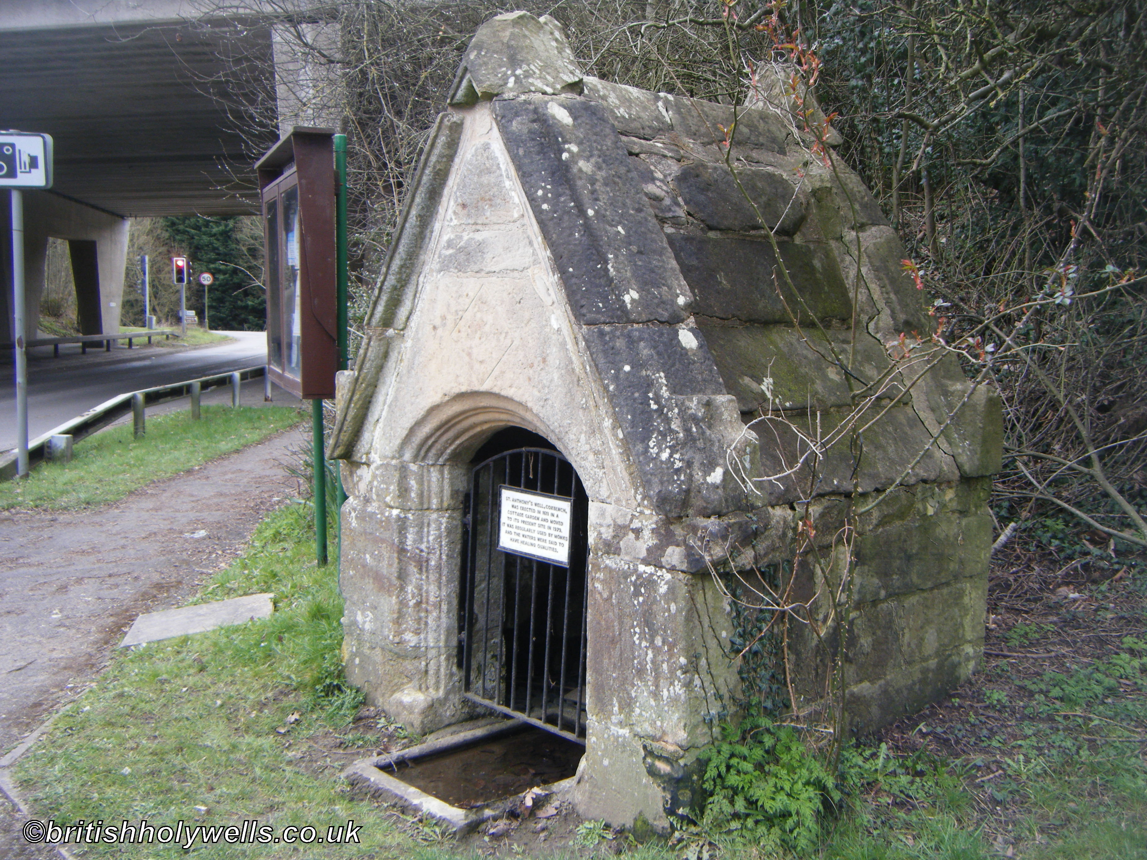
Unfortunately, whilst some of the plaque's claims are verifiable, others are not, and it is not clear where much of this information came from. What is certainly accurate is the date that the plaque gives for the well-house's construction: stylistically, the building bears the hallmarks of an early 17th century design, and the structure's walls are sufficiently weathered to eliminate the possibility of a more recent construction date. Of course, this well-house must have replaced some earlier structure, perhaps a similar one that was destroyed in the Reformation.
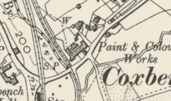
Intriguingly, St Anthony's Well was marked on Ordnance Survey maps (though not named) until 1914, after which it mysteriously disappeared from the maps; even a highly detailed OS map of Coxbench from 1960 fails to mark anything on its site. Nonetheless, St Anthony's Well definitely existed at this time. The only plausible explanation for this strange occurrence is that the structure must have become so overgrown in the garden that housed it that OS surveyors failed to notice what it was, or even that it existed. This is not unusual, and several holy wells across Britain have been accidentally missed off maps because the surveyors were either looking for them in the wrong place, or because they simply did not see them.
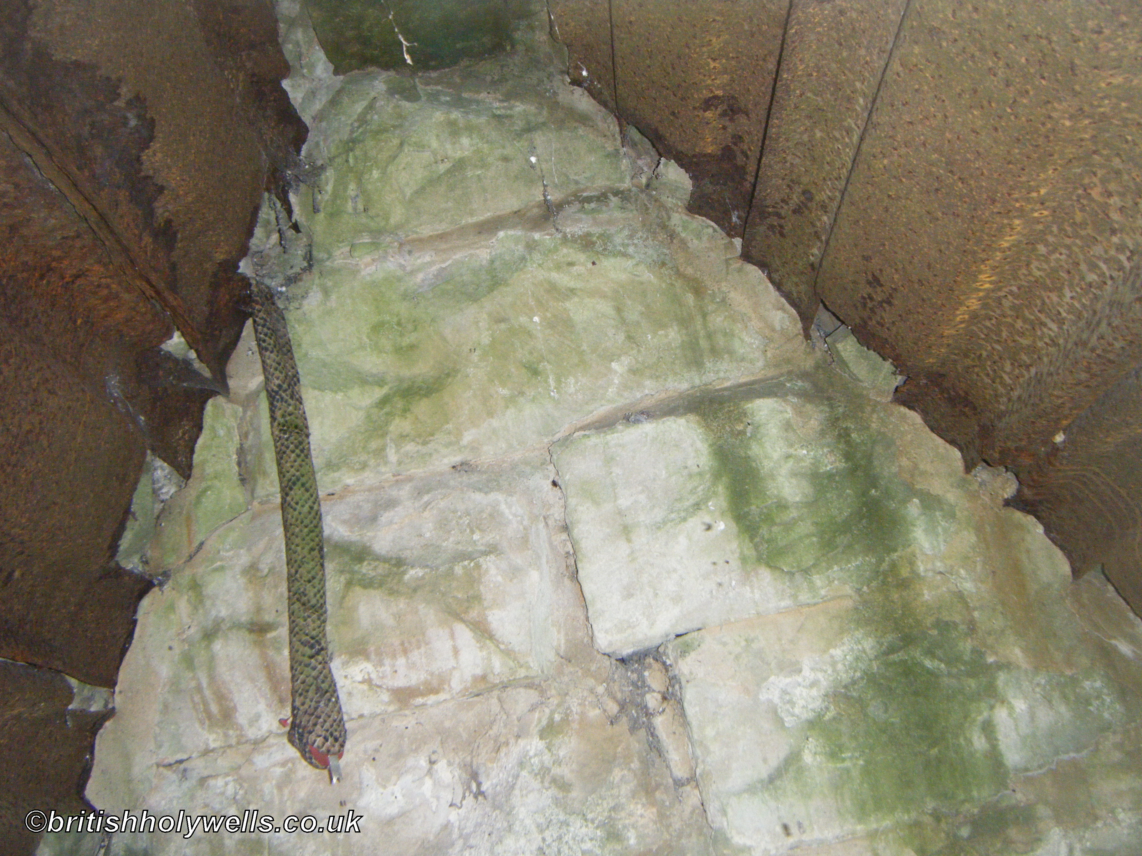
In 1979, Coxbench was cut in half by the A38, which happened to be constructed directly over St Anthony's Well, destroying any trace of the spring. Fortunately, however, the 17th century well-house was saved, and moved a few metres to the south-east, where it can still be seen at the side of the road. When I visited the remains of St Anthony's Well in March 2025, the well-house was in remarkably good condition. It was evidently rebuilt when it was moved, as the inside of the roof has been lined with now-rusted corrugated metal, and the sign was probably added at this time.
 |
 |
*This location and the point on the map refer to the site of St Anthony's Well; the surviving well-house is located at SK3719843572
Images:
Old OS maps are reproduced with the permission of the National Library of Scotland
Copyright 2025 britishholywells.co.uk