 |
Dedication: Saint Michael the Archangel Location: Arthuret Coordinates: 55.00047N, -2.97233W Grid reference: NY378677 Heritage designation: Grade II listed building |
HOME - ENGLAND - CUMBERLAND
|
Dedication: Saint Michael the Archangel Location: Arthuret Coordinates: 55.00047N, -2.97233W Grid reference: NY378677 Heritage designation: Grade II listed building |
Church dedications to St Michael, particularly those located on hills or on high ground, are generally held to indicate the past presence of important pagan sites, such as stone circles, and Arthuret's parish church, situated on the crest of a hill, is certainly no exception to this rule. In fact, it is traditionally said that the famous St Mungo, who, as a missionary, was active in this approximate area during the 6th century, was responsible for its foundation.
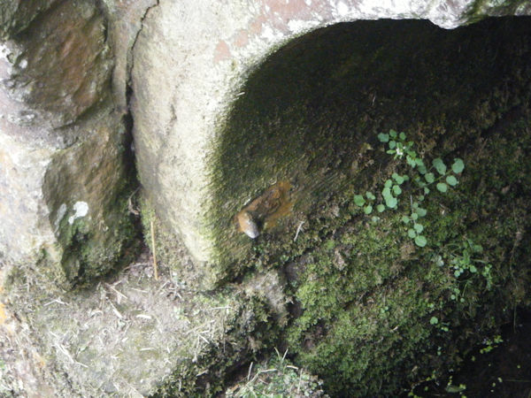
Although St Michael's Well clearly takes its patronage from that of the church, presumably as a result of its water being used there for baptismal purposes, it is impossible to tell whether it too was originally a pagan site that was later Christianised. Nonetheless, the holy well must have been in existence relatively early on in the church's history, as it undoubtedly would have served as the building's sole water supply. Of course, it is not known how exactly the spring would have been used in medieval times, and the earliest reference that I have found to the site dates from the late 18th century, when it was described as "a well of excellent water" in the second volume of The History and Antiquities of the Counties of Westmorland and Cumberland, written in 1777 by Joseph Nicolson and Richard Burn.
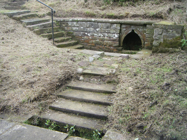
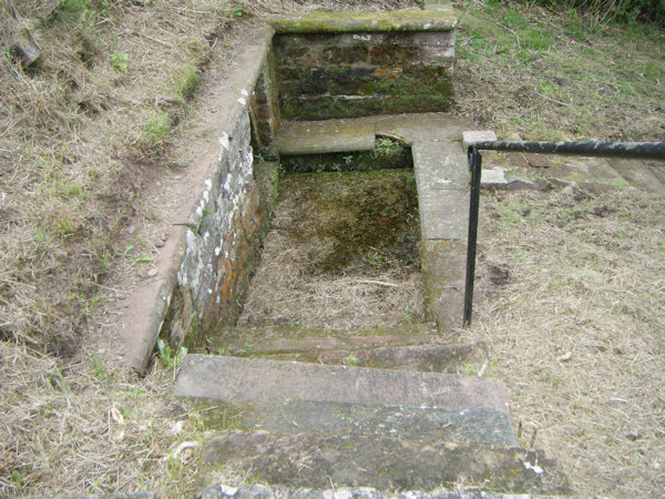
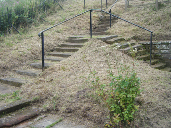
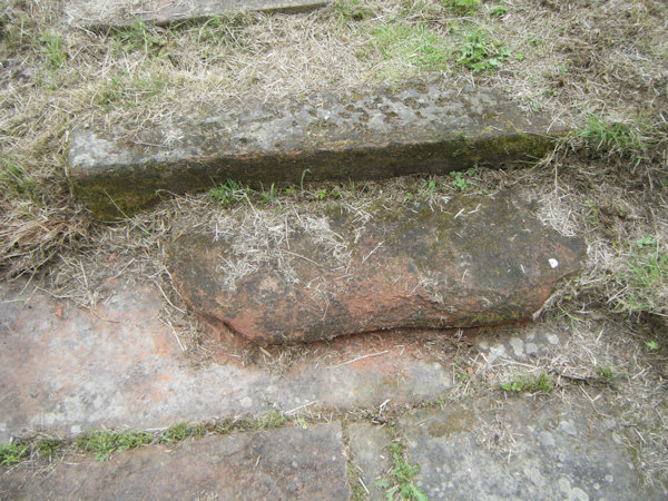
Unfortunately, little more is recorded regarding the site, although it was most probably still in regular use by the 17th century, which is when St Michael's Well is thought by many to have been remodelled. The current church, built from a red-coloured sandstone, was constructed in 1609 (on the site of an earlier building); as the structure that houses the spring appears to be made of this very same material, it is quite plausible that the well was significantly altered or renovated at this time, in conjunction with the rebuilding of the church. Indeed, the unusual arch beneath which the spring arises does bear the hallmarks of a 17th century design. However, it seems unwise to jump to the conclusion that the entire construction was then rebuilt from scratch, especially given the fact that the set of steps that leads down to the spring is incredibly worn. Between 1609 and the present day, it is unlikely that the steps would have been in sufficient use to cause this erosion, simply because St Michael's Well appears to have been used solely for baptisms from the Reformation onwards. This suggests that the steps, if nothing else, pre-date these alterations (assuming that these alterations ever did occur, and that the rest of the structure is not much older than is commonly claimed); if the steps are indeed of an early 17th century date, then the well must have been in abnormally frequent use.
It is not clear how long baptisms were carried out at the spring for, and a rather ambiguous statement included by R. C. Hope in The Legendary Lore of the Holy Wells of England (1893) sheds no further light on the issue. Hope wrote that the well was "still looked upon as the ancient place of baptism", but it is not obvious whether this means that its water was still used for religious purposes, or whether its former use was simply remembered by the locals. (I have been unable to verify modern claims that St Michael's Well was used for baptisms into the 1970s.) Either way, the holy well seems to have fallen into some disrepair by the mid 19th century, which most probably occasioned its cleaning out in 1964. At this time, the site was also apparently the subject of an archaeological excavation; unfortunately, I have been unable to find a record of this investigation's results.
When I visited St Michael's Well in July 2025, it was in a decent state of repair, although it was in dire need of a clean: the large pool in front of the spring was clogged up with dead grass and weeds. This well is, nevertheless, one of Cumberland's more well-known holy wells, and there was even a wooden sign-post in the churchyard that pointed towards the site.
 |
 |
 |
 |
|
Access: A public footpath runs right beside the well. |
Copyright 2025 britishholywells.co.uk