 |
Dedication: Saint Laurence Location: Nantwich Status: lost |
A lazar house or leper hospital, dedicated to St Laurence and connected, at least during the mid 14th century, with the Abbey of Combermere, existed at Nantwich for at least two centuries. The earliest known documentary reference to the existence of this institution is found in an inquisition that was, according to James Hall's History of the Town and Parish of Nantwich (1883), "taken at Minshull before Thomas le Yong" in the 28th regnal year of Edward III (1354-1355). Hall published in his History a translation of the original Latin document, which calls Nantwich "Wich Malbank":
|
The aforesaid Jurors say that [the Abbey of Combermere] is possessed of the Hospital of St. Lawrence at Wich Malbank: in which there ought to be one chaplain to sing divine service every day; and in which there ought to be three beds for the reception of poor sick people where they shall remain until they shall have recovered health; and that a certain service has been withheld for four years now elapsed; and it is now valued at 20 shillings per annum. |
The hospital was still in existence when the "Rentals of Abbey Lands in Nantwich" were compiled, during the 14th year of Henry VII's reign (1498-1499); this document records that the position of "chaplain of the ffree [sic] chapel of St. Lawrence in Nantwich" was then held by a man named "John ffowler" [sic], and that it was still under the governance of Combermere Abbey. By 1525, the hospital was, according to the Valor Ecclesiasticus, "worth £4 per ann.", a large increase from the organisation's yearly value of "20 shillings" in 1354 (equivalent to approximately £800 today) to, in 1525, a sum roughly equal to £2,800 today. Its fortunes did not last for much longer, however, because the institution was officially dissolved in 1548, the original building presumably being demolished some time afterwards.
It is interesting to note that a large number of late 18th century, and early 19th century, local historians assert that the hospital was once accompanied by some kind of priory or abbey, citing as evidence the fact that, to quote volume 2 of The History of Cheshire (1774), "what is called the prior's obiit [sic] is collected by the pariſh-officers to this day". This "prior's obiit" appears to have been collected as part of the parish tithes, and although it does appear to suggest that some kind of priory originally existed at Nantwich, there is absolutely no other evidence to support this theory, most notably a distinct lack of any historial documentation. For this reason, it is not clear whether the local tradition regarding the hospital's location is completely reliable either.
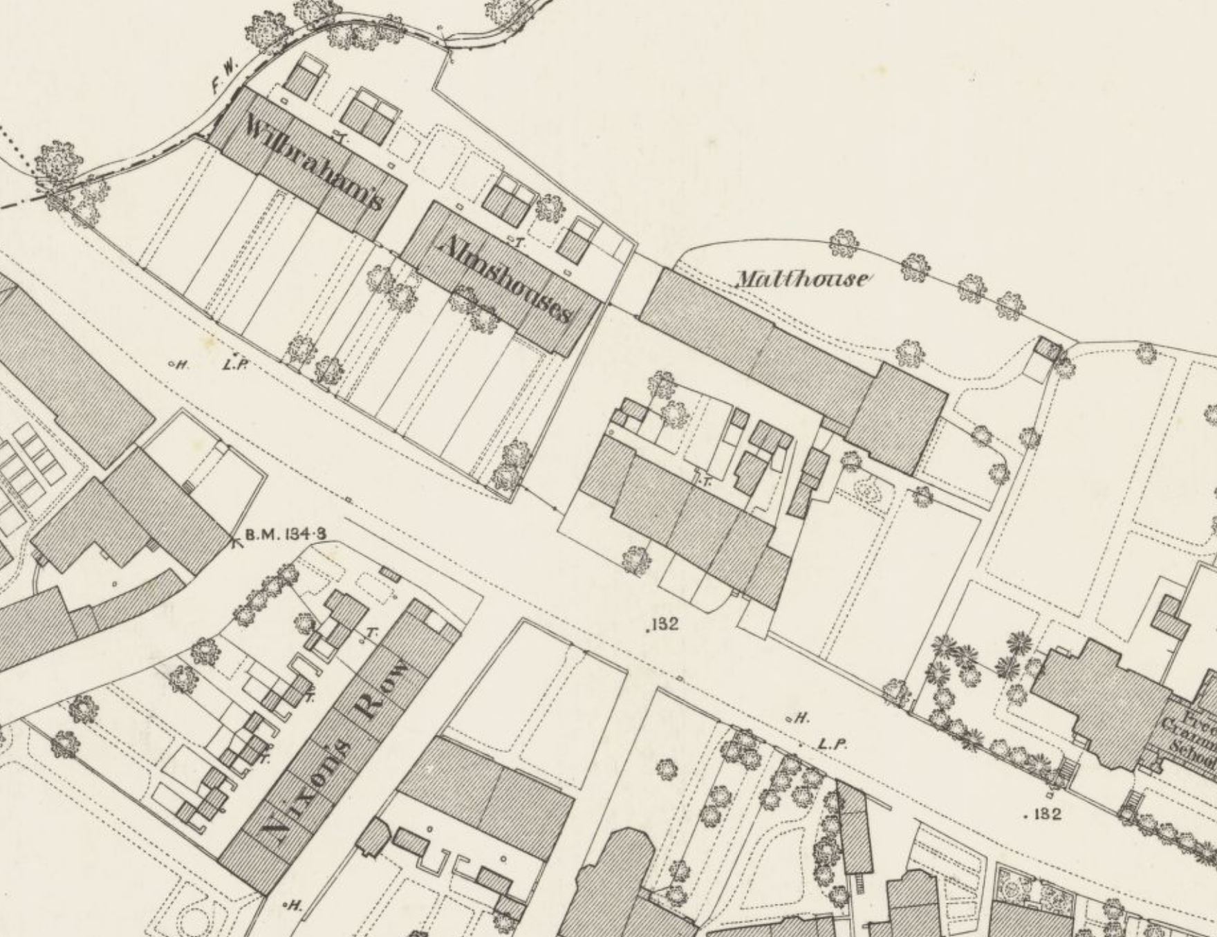
According to a local tradition that is recorded in a number of old histories of Nantwich, the site of the hospital is occupied by a set of alms houses, at, if James Hall is to be believed, "the road-side at the western entrance" to the town. The aforementioned History of Cheshire, written by an anonymous author in 1774, contains the earliest reference that I have found to this tradition, and asserts that "it is generally agreed" that the hospital was "ſituated over againſt the alms-houſes, founded and endowed by the very worthy and ancient family of Wilbraham", and on a "part of" the ground then covered by "the malt-houſe occupied by Mr. James Bayley". Both the Wilbraham alms houses and the malthouse were marked on the 1878 Ordnance Survey town plan of Nantwich (the OS surveyors evidently misunderstood the local tradition, because the map places the "Supposed Site of St. Lawrence's Hospital" over another set of alms houses located further to the east), although only the alms houses survive intact to this day. Of course, the accuracy of this location is questionable, for the simple reason that it is based purely on a local tradition that may well be unreliable.
Regardless of the hospital's true original location, it is clear that St Laurence's Well was directly linked to it. It is not uncommon for religious hospitals to have possessed a holy well dedicated to their patron saint (examples include St John's Well at Lutterworth, associated with St John the Baptist's Hospital, and St Mary Magdalene's Well at Bamburgh, linked to St Mary's Leper Hospital), and it is most probable that these springs served as the institution's primary water supply, possibly also being used for curative purposes within the hospitals themselves.
The earliest mention that I have found of the site dates from some point during the reign of Edward III, between the years of 1327 and 1377, (by which time the hospital is known to have existed), and is found within a medieval grant that appears to use "Laueraunce Wall" as a geographical reference point. Although I have not been able to access this manuscript in its entirety, a very brief description of its contents, published in 1912 in the second volume of the Index to the Charters and Rolls in the Department of Manuscripts British Museum, and edited by Henry John Ellis, shows that St Laurence's Well is of prime interest in the grant:
|
Grant in [Nantwich], near a spring called Laueraunce Wall... [sic] |
Unfortunately, I have been unable to find out any further information relating to this grant, and it is impossible to tell where exactly St Laurence's Well was located. Of course, as stated earlier, the well was certainly connected to St Laurence's Hospital, and is, therefore, very likely to have been situated close to it, presumably, if the local tradition is accurate, near the Wilbraham alms houses, on Welsh Row. However, I have scoured all historic Ordnance Survey maps of the area, and have found no wells or springs that are suitably close to the alms houses to have been the hospital's main water supply, which could mean one of two things: either the hospital was not actually located there, or St Laurence's Well was destroyed at some point before 1878, when the OS town plan of Nantwich was first issued.
|
The point on the map is centred on the Wilbraham alms houses
Images:
Old OS maps are reproduced with the permission of the National Library of Scotland
Copyright 2025 britishholywells.co.uk